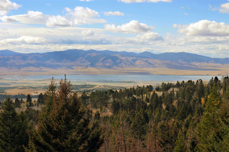
Inside the Target Area

Project Description
The project is located in the upper Missouri River watershed in central Montana, on the west slope of the scenic Big Belt Mountains of Helena National Forest. Ray Creek is visible from the highly popular Canyon Ferry Lake, the Missouri River, State Highway 287, surrounding public lands and the local community. The property is valuable wildlife habitat for elk, deer, bear, moose, sage grouse, mountain lion and many other species of wildlife.
Purpose
Phase I & Phase II: Acquisition of 945 acres to help increase and improve public access to Helena National Forest land and provides habitat for a variety of Montana Species of Concern. One feature of the project is that 2.19 miles of Ray Creek provide a prime source for pure-strain Westslope Cutthroat Trout. Ray Creek provides essential cold water habitat for spawning and rearing of Westslope Cutthroat Trout.
Directions
Located on the west slope of the Big Belt Mountains near Townsend MT, Ray Creek is accessible via Highway 12 by a county road and Forest Road No. 4178. Check with the Townsend Ranger District for specific directions to the property and for any seasonal restrictions.
Restrictions
Please check with the Townsend Ranger District; 415 S. Front; Townsend, MT 59644 406.266.3425 for any seasonal travel restrictions.


