Outside the Target Area
Sponsors

Project Description
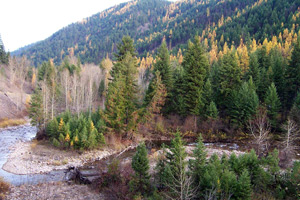
A mixture of National Forest land and small private patented lands, the Cedar Creek lands are located approximately two miles south of Superior, MT. Rolling hills mantled with pine trees and winding creeks characterize the area, which is contained within the Lolo National Forest. Cedar Creek is a crucial site in the preservation of fluvial bull trout and westslope cutthroat trout species. A major tributary, the middle of Clark Fork River supports the spawning of these fish.
Purpose
Protect critical habitat and riparian areas and allow recreational access.
Acquisition of approximately 204 acres of private land at Cedar Creek is crucial to maintain the local fish species. Funds provided by the Montana Fish & Wildlife Conservation Trust were devoted to the purchase of this critical riparian habitat in an effort to prevent future subdivision of the fish population. The U.S. Forest Service will manage the property according to project goals.
Directions
Approximately 2 miles south of Superior, Montana on the Superior Ranger District of the Lolo National Forest.
Restrictions
No Mining


